Santa Fe Trail Ranch Maps
This page includes the following SFTR maps:
You can click on the map links above to jump to their position on this page.
SFTR Ranch Map
Click on the PDF link in the Documents section if you want to print this easier.
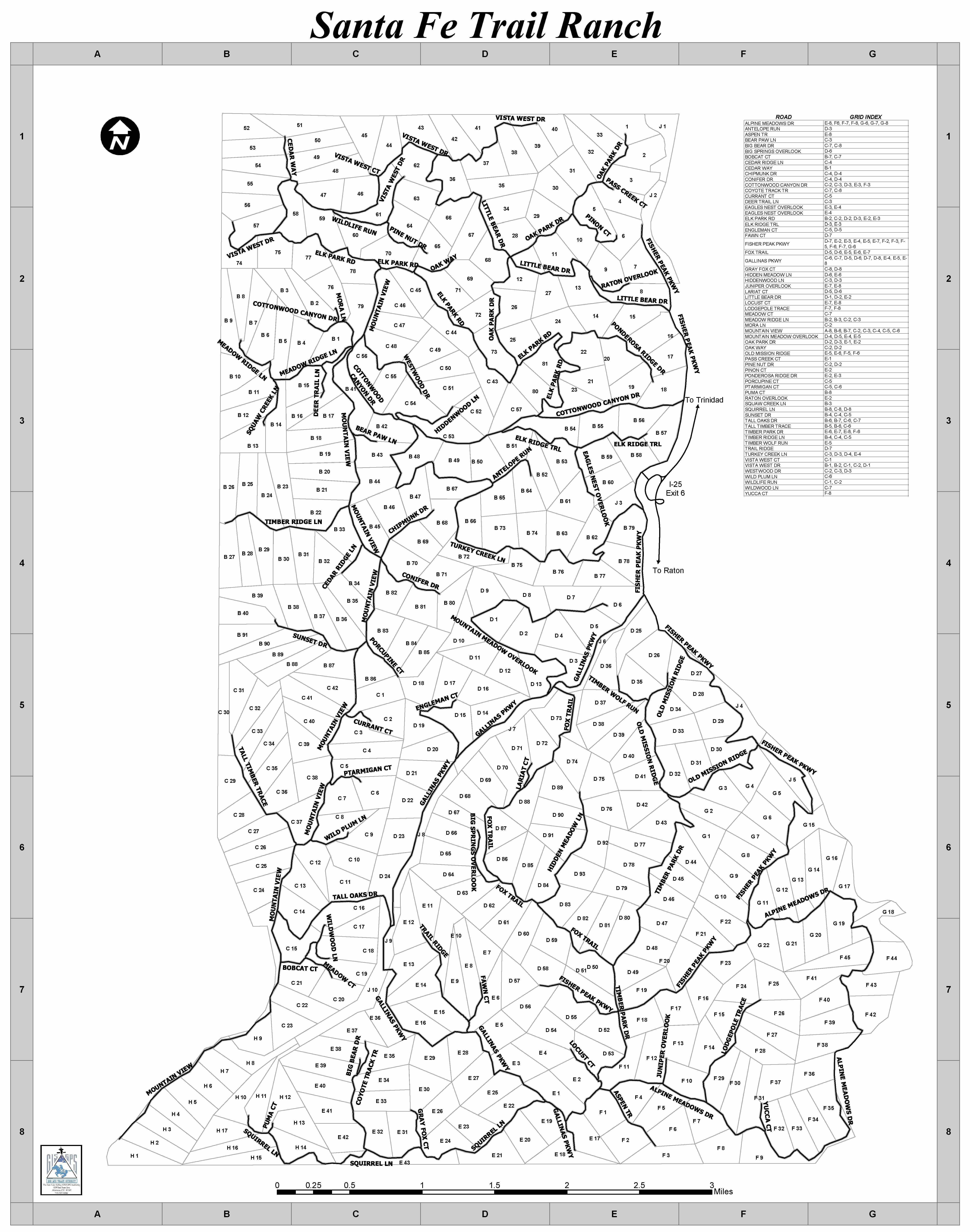
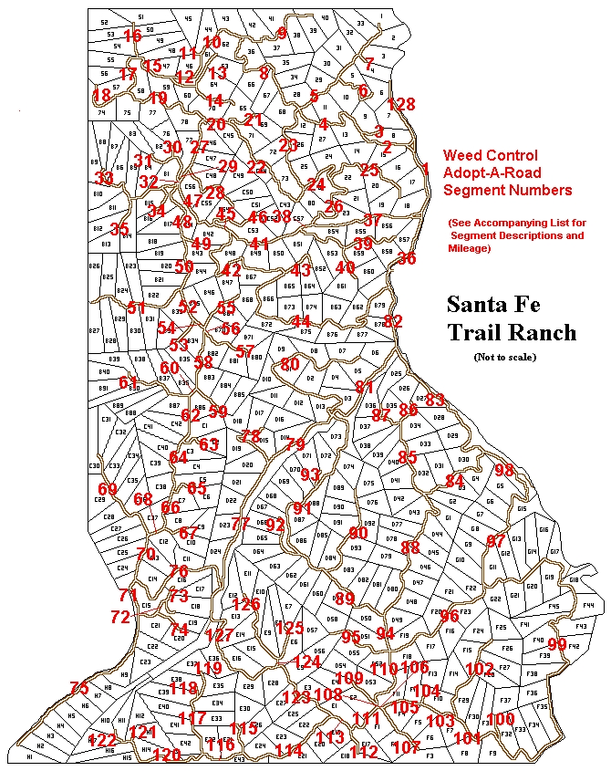
SFTR Weed Control Adopt-A-Road Map
Santa Fe Trail Ranch has a legacy of aggressively controlling noxious weeks that can invade ranch property and rob the land of precious moisture. The POA provides herbicide that effectively controls various types of thistle, Mexican locust, Houndstongue, and Mullen when properly applied. The herbicide is provided to property owners in early spring and it can be applied throughout the growing season.
The following map divides the roads on SFTR into numbered segments. Each road segment has either been adopted by a volunteer or is AVAILABLE and waiting for someone to step forward.
For info on how you can help, click here to go to the SFTR Weed Control Committee webpage.
Click on the PDF link in the Documents section if you want to print this easier.
Santa Fe Trail Ranch Maps This page includes the following SFTR Maps: SFTR Ranch Map SFTR Weed Control Road Segments Map SFTR RANCH MAP: SFTR Weed Control Adopt-A-Road Map Santa Fe Trail Ranch has a legacy of aggressively controlling noxious weeks that can invade ranch property and rob the land of precious moisture. The POA provides herbicide that effectively controls various types of thistle, Mexican locust, Houndstongue, and Mullen when properly applied. The herbicide is provided to property owners in early spring and it can be applied throughout the growing season. The following map divides the roads on SFTR into numbered segments. Each road segment has either been adopted by a volunteer or is AVAILABLE and waiting for someone to step forward. For info on how you can help, click here to go to the SFTR Weed Control Committee webpage. Click on the PDF link in the Documents section if you want to print this easier.


